About the Delaware HWM Project
Background
A high water mark (HWM) is a line found on trees and structures marking the highest elevation of the water surface for a flood event, created by foam, seeds, or other debris.
HWMs typically represent total water level, also known as "storm tide", consisting of storm surge plus astronomical tides, and not simply storm surge alone.
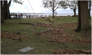
Delaware Storms & Flooding
Delaware's low-lying elevation, concern of sea-level rise, frequency and intensity of meteorological events, susceptibility to high storm surge, and increasing community population along the coast all emphasize the need to better analyze, monitor, and document the magnitude and extent of coastal flooding.
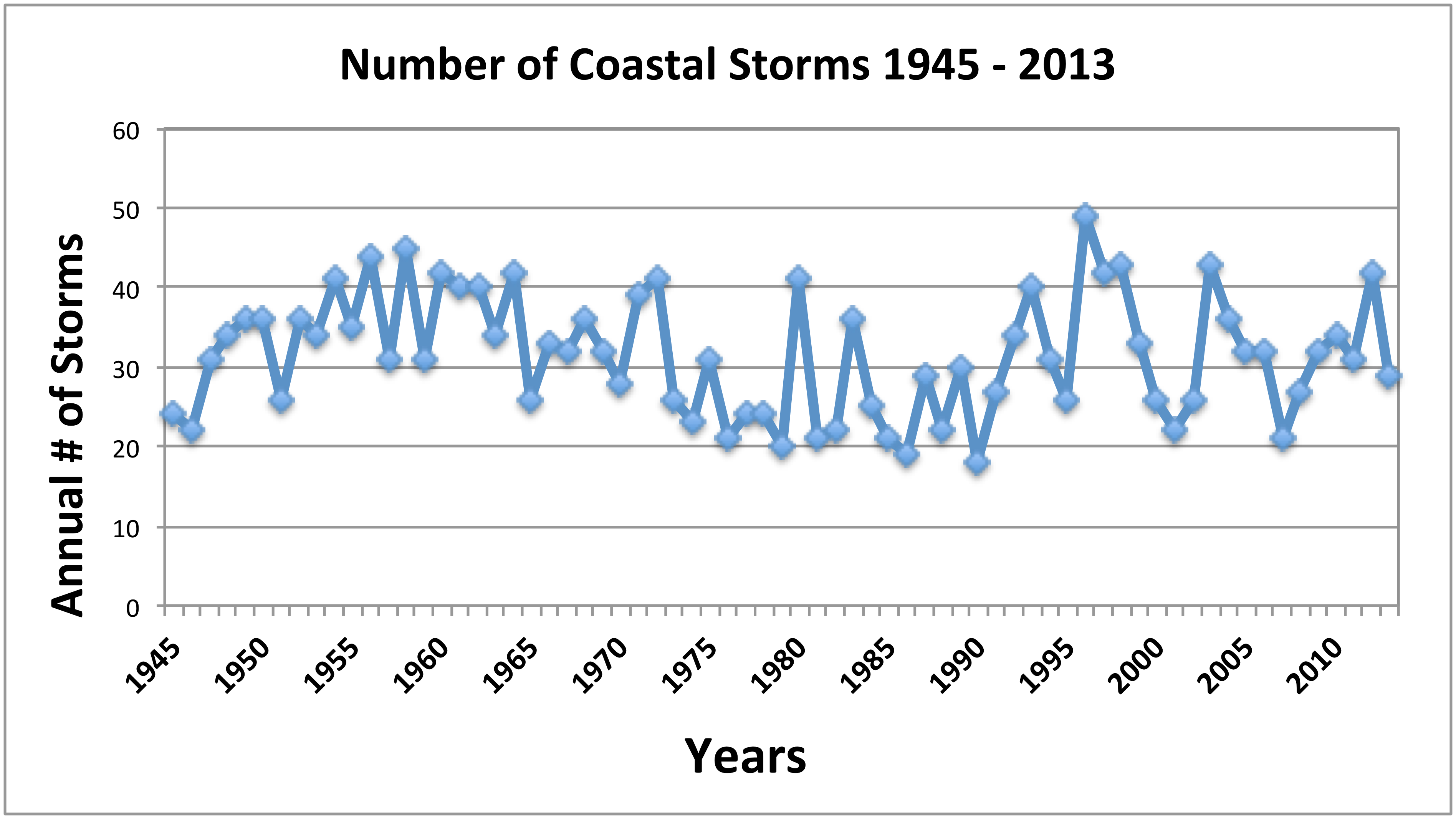
The graph to the left shows the number of storms per year that passed within 200 miles of Delaware's coast since 1945. Out of 2000+ storms approximately 85 have been significant meteorological events.
Documenting High Water Marks
HWMs have many important uses for the emergency management, planning, and risk assessment and mitigation industries.
In Delaware, after significant meteorological events, efforts are made among several federal, state and local organizations (DNREC, DGS, USGS, DEMA, DelDOT, county EOCs, University of Delaware) in order to document the impacts of the event.
- There is currently no standardization among collecting agencies for archiving, displaying, or making the HWM data available to others.
- There is no technical infrastructure in place to support a multi-agency effort in HWM data collection.
- HWM data often stay with the data collecting agency.
- There is a lack of spatial and temporal coverage of HWM observations.
Project Goals
- Collect historical high watermark and peak storm-tide data.
Historical event data were aggregated from tide gage observations, published reports, local agency records, and other sources. Observed HWM and storm tide data will be calibrated across the spatial dimensions.Through multi-agency collaboration, the project team will also summarize past HWM and peak storm tide collection activities and how the data is typically shared among Delaware organizations.
Post-event field observations of HWMs will be documented noting the possible influence of waves on the water surface elevations, on georeferencing methods, and other characteristics.
- Develop a database & web-based display and distribution system.
Data collected from the historical HWM and peak storm-tide observations will be synthesized into a standardized database. A publicly-available website will visualize the synthesized data helping State of Delaware professionals to make better decisions and to better inform the citizens of Delaware.
The interactive website will include: maps of maximum water level values by event at many observation locations throughout Delaware and filtering of the database by event name, maximum water level, location, and other noteworthy parameters.
- Increase spatial coverage of sensors.
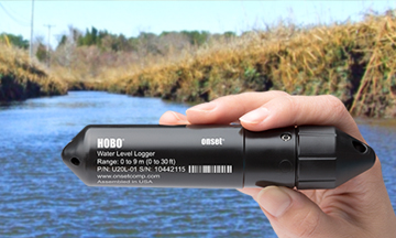 To increase the spatial and temporal monitoring of future flood events, DEOS will work closely with DNREC, USGS, and other hydrologic monitoring agencies across the state to deploy low-cost, commercial sensors in areas expected to be inundated.
As a storm approaches, areas that are forecasted to be hardest hit and without existing monitoring capabilities will be targeted for this short-term monitoring and sensors would be deployed days before the storm hits.
With careful coordination among agencies, data from these sensors will hopefully paint a more detailed picture of the spatial extent and severity of coastal inundation across the state.
- Collaboration.
By strengthening the partnerships among agencies that support surface water monitoring in Delaware, this project will help to promote ongoing future dialogue and coordination for documenting flooding events in the future.
The needs of these groups will be incorporated into attribution methods of the HWM field observations and will also be incorporated into the database design. This will establish a strong standard through which future events can be documented.
Partners
The Delaware HWM Database project is a collaborative effort between the Delaware Geological Survey (DGS), the Delaware Environmental Observing System (DEOS), and the Delaware Environmental Monitoring & Analysis Center (DEMAC).
This project was funded using Federal funds under awards NA14OAR4170087 from the Delaware Sea Grant Program through the National Sea Grant College Program, National Oceanic and Atmospheric Administration (NOAA), U.S. Department of Commerce.